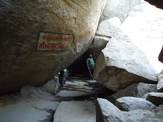
Gradually the slope becomes more steep and steps have sometimes been cast out of concrete and at other places have been carved out of rock.
At places railings have been provided for support but at many places where the slope is steep, there are neither steps nor railings. For persons who are not too sure of their feet it is advisable to carry a sturdy walking stick to negotiate slippery rock slopes. This stick would double up as a defence against attacking monkeys.
For a man not in the peak of fitness and who is sixty years old, it would take about one hour to ascend to the cave temple where a Shiva linga with a metal hood of a snake is placed within the cave. Before you enter the cave you are asked to remove your footwear and a person will guard it for you for the payment of a nominal fee (5 rupees). Be sure to carry adequate supplies of bottled water (can be bought very chilled at Tovinakere by people who follow the route suggested by us, or at Koratagere by people who follow the other route). We found that the water had retained its coldness even when we reached the summit. For trekkers who wish to snack at the summit we suggest that you carry it from home or from Tumkur. Along the route only cut seasonal fruits - we found muskmelon and watermelon in late March - and of course, bananas are sold. Refreshing cups of tea or salted buttermilk are available at the top for the fatigued.
I was lucky to meet a youth of about 21 years called Vinod who offered to guide me around the caves and other spots of interest. I was interested in scaling the summit and hence enlisted his help. He is a student and does not specify any fee for his effort but leaves it to your discretion. (Vinod's Mobile No. 90193 44608 he is available on Sundays and holidays) He took us first to the summit which you have to reach by crawling through crevices formed in the rock. (see foto on right)
By weaving through boulders and crevices we reached what is called the Ardha Chandra Sarovar at some distance below the summit. This is a tiny pond with water filled with algae that gives it an ominous green colour.
Further ascent takes you to the ruins of a fort at the summit. Our guide Vinod tells me that these were built in the 16th Century by a local chieftain called Kurangaraya. He also tells me that the hill has been referred to as Suvarnagiri. It was during Kurangaraya's time that Siddhi Purushas like Rudramuneeshwara inhabited the caves that are found on this hill.
But more about that later !
From the summit you get spectacular views of the surrounding terrain as seen in the following photographs:
View from Summit
Karthik and Vinod view the scarp face
There is another Shiva temple with a linga on the summit. The summit has a sheet layer of granite that forms an impressive tabletop like structure. The foto on the left shows Karthik and Vinod approaching the Shiva temple fashioned out of rock slabs.
The Shiva Linga inside the temple.
 |
| A Panoramic view from a point midway up the hill (scene formed by fusing photographs) |
Continued in Part 3 ...


No comments:
Post a Comment